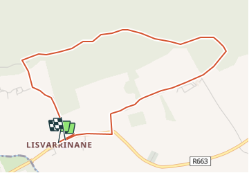
Trail Walking The Municipal District of Cahir — Cashel - Carroll''s Loop - Photo
© OpenStreetMap contributors
Length
Length
4.5 km
Max alt
Max alt
191 m
Uphill gradient
Uphill gradient
104 m
Km-Effort
Km-Effort  
5.9 km
Min alt
Min alt
101 m
Downhill gradient
Downhill gradient
100 m
Boucle
Boucle
Yes
Creation date :
2014-12-11 00:00:00.0
Updated on :
2014-12-11 00:00:00.0

(0 Reviews)

Walking
Walking
1h18
Difficulty : Unknown

Scan this QR Code to open this trail in the SityTrail application

FREE GPS app for hiking

Logo SityTrail SityTrail

IGN / Geographical institutes

Download SityTrail from the App Store Download SityTrail from Google Play

Logo SityTrail SityTrail Plus

The world is yours!

Download SityTrail from the App Store Download SityTrail from Google Play Download SityTrail on Huawei AppGallery

About

Trail Walking of 4.5 km to be discovered at Unknown, County Tipperary, The Municipal District of Cahir — Cashel. This trail is proposed by mlmoroneybb.

Description

When William Bulfin, author of Rambles of Eireann, arrived at the top of Slievenamuck and looked down on Lisvarrinane he was completely captivated by what he saw and wrote ??the brightness and freshness of its beauty are entrancing? Those green, swelling, smiling fields, that silver stream, the heather clad slopes of the Galtees, and the thick woods along the northern hills are glorious?

Elevation profile

Positioning

Country:
Ireland
Region :
Unknown
Department/Province :
County Tipperary
Municipality :
The Municipal District of Cahir — Cashel
Location:
Clonbeg
Start:(UTM)
552549 ; 5807117 (29U) N.


Close
My subscriptions